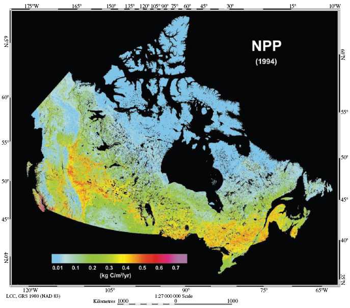
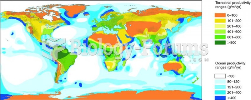
Terrestrial primary production is generally limited by temperature and moisture. As we surveyed the major terrestrial biomes in chapter 2, you probably got a sense of the geographic variation in rates of primary production. Perhaps you also developed a feeling for the major environmental correlates with that variation. The variables most highly correlated with variation in terrestrial primary production are temperature and moisture. Highest rates of terrestrial primary production occur under warm, moist conditions. The importance of temperature and moisture to net primary productivity can clearly be seen in a map of primary productivity across Canada (fig. 19.2). This map was developed by Jing Chen and colleagues from the Canada Centre of Remote Sensing based at the University of Toronto (Liu et al. 2002). Describing patterns across a large geographic extent, such as the whole of Canada, cannot be done with traditional field samples. In chapter 1 we first presented the idea that larger-scale sampling, often involving remote sensing done by satellites, has opened up an area of research unimaginable just a few decades ago. We discuss the importance of remote sensing to address questions in “large-scale†ecology in chapter 22, and here it is enough to recognize that the data collected by Chen and colleagues was acquired through image collection and analysis, rather than purely field sampling.
Related Images
262
82
124
5611
185
93
186
283
286
965
Add Comment
0 Comment
Explore
Post your homework questions and get free online help from our incredible volunteers