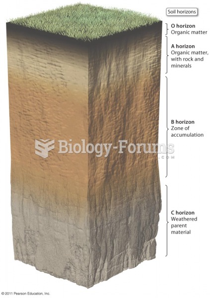
The quality of a soil is most directly related to:
A) its texture.
B) its capacity to perform the functions you want it to.
C) its acidity or alkalinity of the soil.
D) its resistance to soil erosion.
E) its capacity to regain lost organic matter.
Question 2Which satellite image would be said to have the highest resolution?
A) A 100 100 m object is just barely discernible. B) A 30 30 m object is just barely discernible.
C) A 10 10 m object is just barely discernible. D) A 50 50 m object is just barely discernible.
Question 3A 20 km long road would be a line ________ cm long on a 1:200,000 scale map.
A) 2 B) 10 C) 20 D) 40 E) 100
Question 4For most planning projects using a geographic information system, getting the needed data into the system is the easy part, but developing the computer Tables and maps is extremely time-consuming and difficult.
Indicate whether the statement is true or false
Question 5In evaluating a site for a septic drainfield, an undifferentiated group mapping unit would be more helpful than a soil complex mapping unit.
Indicate whether the statement is true or false
Question 6If a developing country signed a two-year contract with a private soil science firm to make a soil survey of the entire country (about 1 million square kilometers), the survey stipulated would likely be a first or second order survey.
Indicate whether the statement is true or false
Question 7Soil Associations are usually used for large scale soils maps.
Indicate whether the statement is true or false


 Quick Reply